Hiking in Rwanda covers volcano climbs in Volcanoes National Park, rainforest trails in Nyungwe Forest, forest walks in Gishwati Mukura and the long distance Congo Nile Trail along Lake Kivu. The headline hikes are Mount Bisoke at 3,711 metres, Mount Karisimbi at 4,507 metres and Mount Muhabura at 4,127 metres, all in the Virunga chain. Nyungwe holds over 130 kilometres of marked forest trail, and the Congo Nile Trail runs for roughly 227 kilometres.
Rwanda calls itself the land of a thousand hills, which is accurate to the point of understatement. Almost nothing here is flat, and the hiking is better than the country’s reputation as a gorilla destination suggests. Most visitors never walk anything except the trek to a gorilla family, which leaves some of the best trails in East Africa comparatively quiet.
Safaris built around hiking
Volcano Hiking in Volcanoes National Park
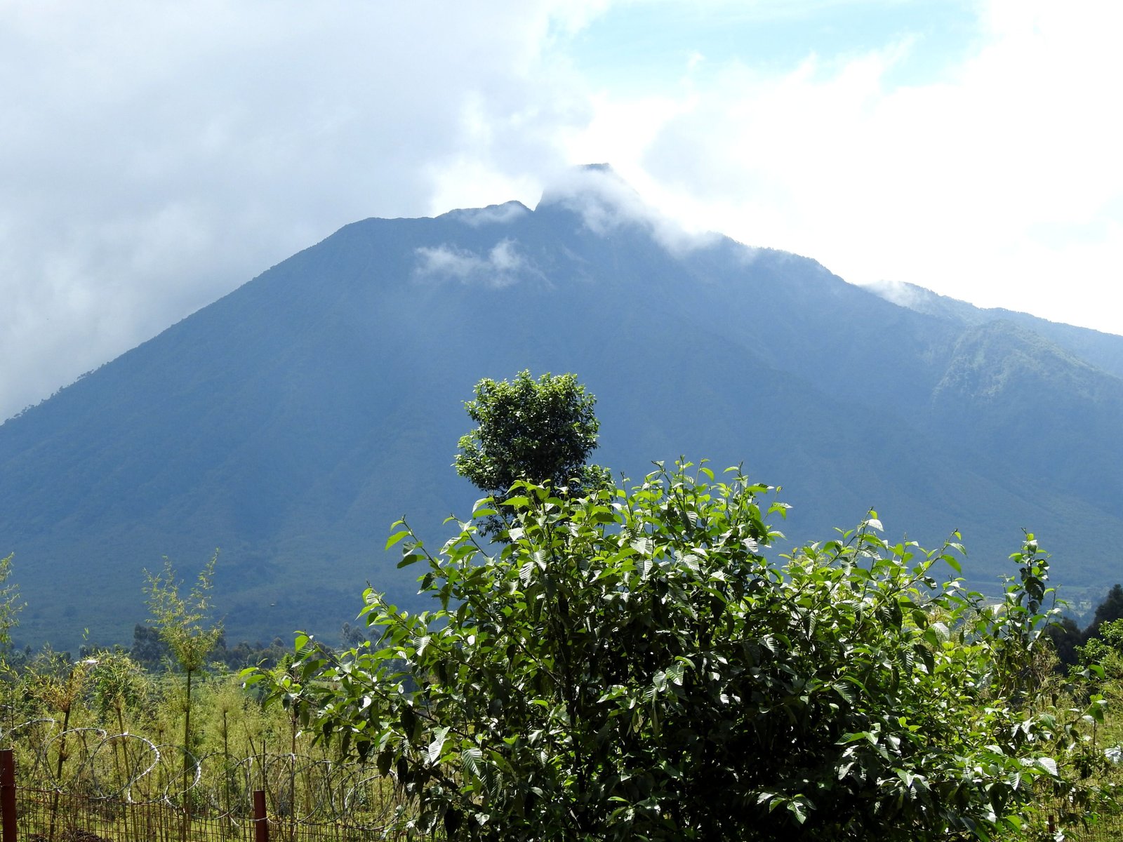
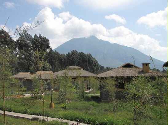
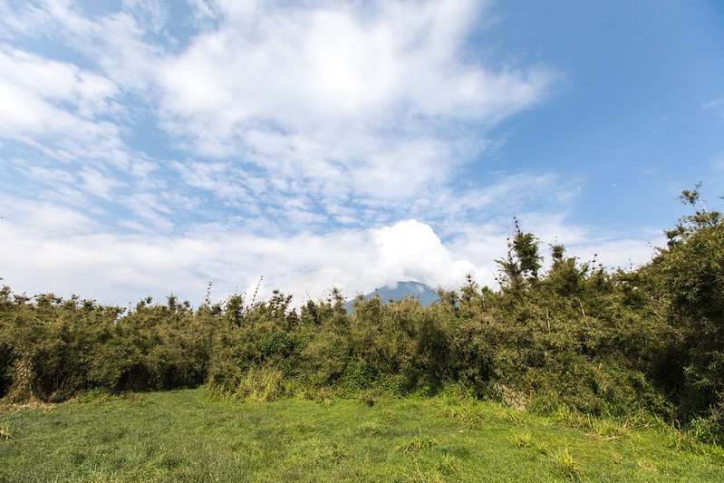
Volcano hiking is Rwanda’s flagship walking activity and it happens along the Virunga chain in the northwest. The park protects five of the eight Virunga volcanoes, all dormant, rising from farmland into bamboo, hagenia woodland and finally the strange afro alpine zone of giant lobelia and senecio.
Everything starts at Kinigi park headquarters, with hikes usually briefed at seven in the morning, the same hour as the gorilla treks. Guides and rangers accompany every group, independent walking is not permitted, and porters are available at the trailheads.
The altitude is the part people underestimate. Trailheads sit above 2,400 metres and summits run past 4,500, so anyone arriving from sea level a day or two earlier will feel it. The gradients are steep, the volcanic soil holds water for days, and none of these climbs are technical. What they demand is legs, patience and grip.
If you are combining a volcano hike with gorilla trekking, put the trek first and the climb second. Doing Bisoke or Karisimbi the day before a gorilla trek leaves you walking uphill on tired legs with no option to slow down, since trackers are already sitting with the family.
Mount Bisoke Hiking Safari and the Crater Lake
The Mount Bisoke hike is the climb most visitors can realistically do, and the one to book if you only have a day. Bisoke stands at 3,711 metres on the Rwanda and Congo border, with a crater lake roughly 400 metres across sitting in its summit.
Budget six to seven hours in total, commonly around four hours up and two down. There is no scrambling and no exposure, and the first section through bamboo is pleasant walking. The last third is where it changes: a steep gradient on soil that turns to deep mud, and in the wet season it becomes a slow, wearing slog. Trekking poles help more than fitness does. Gaiters help more than poles.
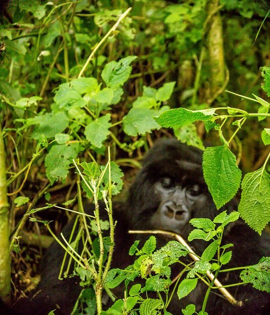
Wildlife on the way is a bonus rather than a promise. Golden monkeys are seen fairly often on the lower bamboo, buffalo and forest elephant leave sign the guides will read for you, and gorilla families occasionally range across the trail, though no ranger will suggest that is likely.
At the top, weather permitting, you look down into the lake and across to Mikeno in the Congo. Weather often does not permit. Cloud closes the summit regularly and the descent is the same mud in reverse, which is where most people slip.
Mount Karisimbi Two Day Trekking Expedition
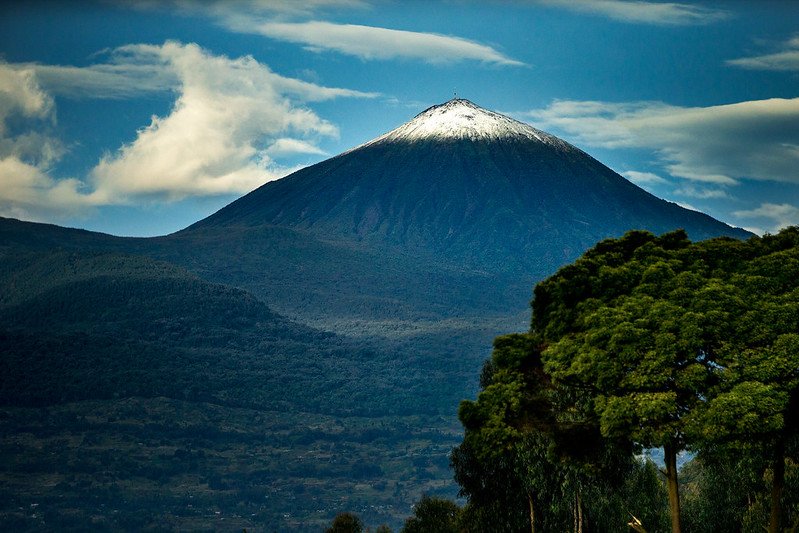
Karisimbi is the serious one. At 4,507 metres it is the highest peak in the Virunga chain and among the highest in Africa, and it cannot be done in a day. A Karisimbi trekking expedition takes two days with a night camped at around 3,700 metres on the saddle below the summit.
Day one climbs through bamboo into hagenia woodland and on into the afro alpine zone. It is cold at camp, there are no facilities, and rain at some point is close to certain. Day two starts before dawn for the summit push, and this is where altitude tells on anyone who flew in from sea level earlier in the week.
The reward is a sunrise view across the whole massif and the knowledge that very few visitors to the park ever get above the gorilla trails. Anyone considering it should be walking regularly at home beforehand. Let the operator arrange porters, tents and camp gear rather than carrying your own, and bring a proper sleeping bag rated for cold.
Mount Muhabura, Gahinga and Sabyinyo Hikes
Three more Virunga volcanoes sit on the Rwanda and Uganda border, and the practical position on each is worth knowing before you plan around them.
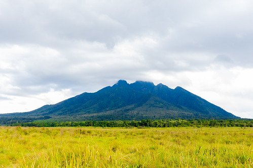
Mount Muhabura, 4,127 metres. The one properly hiked from the Rwandan side, starting at seven from Kinigi. A full day, roughly eight hours and twelve kilometres round trip, with a small permanent crater lake at the summit. On a clear day the view reaches Lake Edward, Bwindi and the Rwenzori peaks. The name means the guide in Kinyarwanda, because it served as a navigation marker for centuries.
Mount Gahinga, 3,474 metres. The smallest and gentlest of the group, around six hours through good bamboo forest to a summit crater that has become swamp rather than lake. Usually hiked from Uganda’s Mgahinga side. A sensible first volcano for anyone unsure about Bisoke.
Mount Sabyinyo, around 3,650 metres. Three peaks, ladders and real scrambling, with the third summit sitting where Rwanda, Uganda and the Congo meet, so you stand in three countries at once. Around eight hours and fourteen kilometres. Almost always climbed from the Ugandan side, where the trail is developed.
Because Muhabura, Gahinga and Sabyinyo straddle a border, a hiking trip built around them often works best as a combined Rwanda and Uganda itinerary rather than trying to do everything from Kinigi.
Dian Fossey Tomb Hiking Trail
The Dian Fossey tomb hike is the gentlest option in the park and the one with the most weight behind it. A short drive from headquarters takes you to the trailhead, then the walk climbs steadily for two to three hours through hagenia forest into the saddle between Bisoke and Karisimbi.
This is where Fossey established the Karisoke Research Centre in 1967 and worked until her death. The original camp is gone, but the foundations remain, and she is buried in the gorilla graveyard she dug herself, alongside Digit and other animals she had known individually.
It suits people who have read about her work or seen Gorillas in the Mist, and the guides tell the story properly rather than as a film summary. Reckon on four to five hours in total. The newer Ellen DeGeneres Campus of the Dian Fossey Gorilla Fund near Kinigi covers the research side, and the two together make a full day that involves walking without demanding a summit.
Nyungwe holds more marked trail than most people manage in a week, and on a typical morning you will meet nobody on it at all.
Rainforest Hiking Trails in Nyungwe Forest
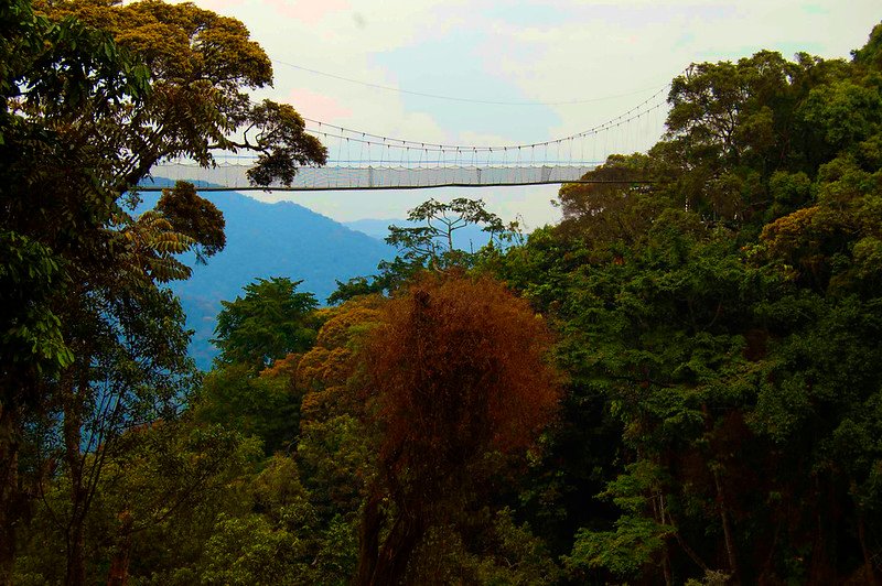
Nyungwe is the best hiking park in Rwanda by a clear margin, with over 130 kilometres of maintained trail and more than a dozen named routes running from three reception centres at Kitabi, Uwinka and Gisakura.
Igishigishigi Trail. Around 2.1 kilometres, about an hour and a half, easy. The canopy walkway route, past giant tree ferns. The busiest path in the park and a good first walk.
Kamiranzovu Trail. Roughly six kilometres, three hours, moderate. Drops to the Kamiranzovu swamp, the largest peat bog in the park, with a waterfall and orchids through the marsh margins.
Isumo Waterfall Trail. About ten kilometres from Gisakura, four hours, moderate with a steep section. Crosses the tea estate before dropping into forest to the park’s biggest waterfall. Colobus and blue monkeys along the edges.
Bigugu Trail. Around 13 kilometres, six hours, difficult. The climb to Bigugu peak, the highest point in the park, with views over Lake Kivu and into the Congo on a clear day. For serious walkers.
Imbaraga and Umuyove Trails. Imbaraga passes four waterfalls on a long loop. Umuyove runs through stands of huge hardwood and medicinal plants. Both from Uwinka.
Congo Nile Divide Trail. Over 40 kilometres across roughly three nights, following the watershed ridge. Mostly ridden by cyclists, though it can be walked.
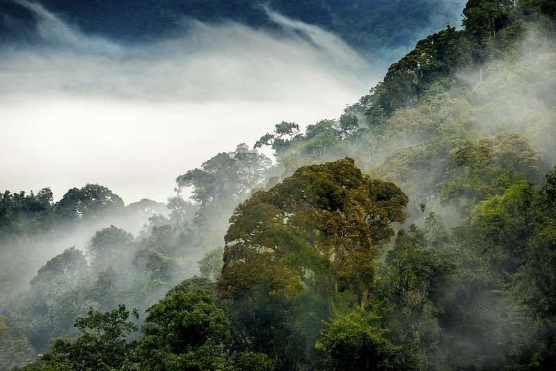
Trails are graded and guides assigned at the reception centres. This forest takes around 2,000 millimetres of rain a year, so leaf litter over wet clay is the standard surface even in the dry months, and balance matters more than cardiovascular fitness.
Hiking Trails in Gishwati Mukura National Park
Rwanda’s smallest national park offers three trails, all guided and all arranged through the community owned guesthouse. It is quiet ground, and the walking has a different character because you are moving through forest that has been deliberately brought back rather than forest that was never cleared.
The Umushwati Trail runs around eight kilometres through the heart of the Gishwati block, doubling as the main primate tracking route. The Matyazo Hill Trail is a three kilometre loop to the highest point in the park at roughly 2,470 metres, often combined with Umushwati into a longer morning. The Waterfall Trail covers about seven kilometres from near the guesthouse, crossing a working tea plantation before following a river valley to a waterfall.
None are technical, though the ground is steep in sections and stays wet. What you notice on the trail is the restoration itself, moving from young planted stands near the edges into older growth deeper in, and guides will tell you which sections went in when.
The Congo Nile Trail Along Lake Kivu
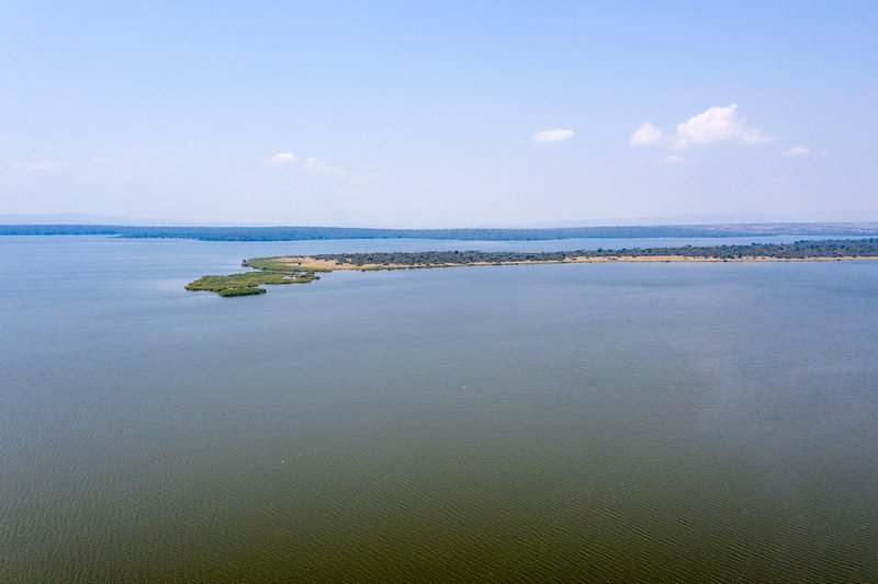
The Congo Nile Trail is Rwanda’s long distance route, running roughly 227 kilometres along the eastern shore of Lake Kivu between Rubavu in the north and Rusizi in the south. Cyclists commonly take five days. Walkers need closer to ten. Plenty of people do a two or three day section instead, which is the sensible way to fit it into a wider trip.
The route passes through fishing villages, coffee terraces, banana plantations and eucalyptus stands, with the lake below and the Congo hills across the water. It is dirt for most of its length and relentlessly hilly, so the riding and the walking are both harder than the distance suggests. Accommodation ranges from guesthouses and homestays to camping.
Kinunu coffee washing station sits on the route and can be reached by bicycle or boat, which makes a natural rest day. Kayaking sections of the shoreline is the gentler alternative for anyone who likes the idea of the trail more than the gradients.
Day Hikes Around Kigali and Beyond
Rwanda has plenty of walking that requires no park permit at all, and these fill arrival or departure days usefully.
Mount Kigali rises directly above the capital, with the usual route starting from the Nyamirambo neighbourhood. The incline is gentle, the views back over the city are good, and there is a wooded area at the top with somewhere to stop for a drink. It takes a couple of hours and needs no arrangement.
Further out, the hills around Lake Burera and Lake Ruhondo, the twin lakes east of Musanze, give shoreline walks with the volcanoes behind them. In the east, a seven kilometre walk follows the boundary fence outside Akagera National Park into the hills, ending on a ridge with views across the park, which takes around two hours.
Almost any road in Rwanda leads uphill into terraced farmland, and walking with a local guide through villages and plantations is one of the more honest ways to spend a spare morning.
Fitness, Altitude and What to Pack for Hiking in Rwanda
Altitude does more damage to hiking plans here than gradient does. Kigali sits around 1,500 metres, the Virunga trailheads above 2,400, and the summits well past 4,000. Give yourself a day or two before attempting Karisimbi or Muhabura.
Footwear. Waterproof boots with ankle support and aggressive tread, worn in beforehand. This is the single most important item and the one people most often get wrong. Gaiters against mud and safari ants.
Clothing. Layers. Cold at dawn, warm by mid morning, cold again at altitude. Long trousers and sleeves against nettles, a proper waterproof jacket, and a fleece. Neutral colours in the parks.
Support. Trekking poles for the descents, which is where injuries happen. Gardening gloves for grabbing vegetation. A porter, hired at the trailhead, for anything longer than a few hours.
Everything else. Two litres of water minimum, snacks or a packed lunch, sunscreen at altitude even under cloud, insect repellent and a dry bag for camera gear. A head torch for pre dawn starts.
Best Time for Hiking in Rwanda
All trails stay open year round and nothing closes seasonally. What changes is how much mud you walk through and whether you see anything from the summit.
June to September, long dry season. The best hiking window without argument. Firmest trails, clearest summit views and the most reliable conditions for Karisimbi and Muhabura. Also the busiest across the parks.
Mid December to February, short dry season. Similar conditions with fewer walkers. A strong second choice, particularly for Nyungwe’s longer trails.
March to May, long rains. The hardest months. Volcanic soil turns to deep mud, the Bisoke descent becomes genuinely unpleasant, and summits are often clouded in. Waterfalls in Nyungwe run at full strength, which is the compensation.
October and November, short rains. Afternoon showers rather than all day rain, especially early on. Quiet trails and reasonable conditions if you start early and finish by lunch.
Planning a Rwanda Hiking Trip
The country’s compactness makes a hiking itinerary straightforward to build. Volcanoes National Park sits about two hours north of Kigali on tarmac, Nyungwe five to six hours southwest or forty minutes by air to Kamembe, Gishwati Mukura between the two on the Kivu road, and the Congo Nile Trail runs the length of the western shore.
A common shape gives two or three days in the Virungas for a volcano and the Fossey trail, then moves down the lake with an optional Gishwati stop, then several days in Nyungwe for forest trails and the canopy walkway. Ten days covers that at a reasonable pace. A week means choosing between the volcanoes and the rainforest rather than doing both properly.
Every hike inside a national park requires a permit and a guide arranged in advance, and Karisimbi in particular needs camp logistics organised rather than improvised.
Rwanda’s trails reward walkers far more than the country’s gorilla reputation suggests, and the planning mostly comes down to sequencing, altitude and honest self assessment about what you can climb. Intare Safaris is Rwandan, works both the Virungas and Nyungwe year round, and can also run the border volcanoes from the Ugandan side where the trails are better developed.
Tell Intare Safaris what kind of walking you enjoy and how many days you have, and they will build a route that matches your legs rather than selling you a summit you would rather have skipped.